TITA Robot Capabilities for Inspection, Mapping and Research
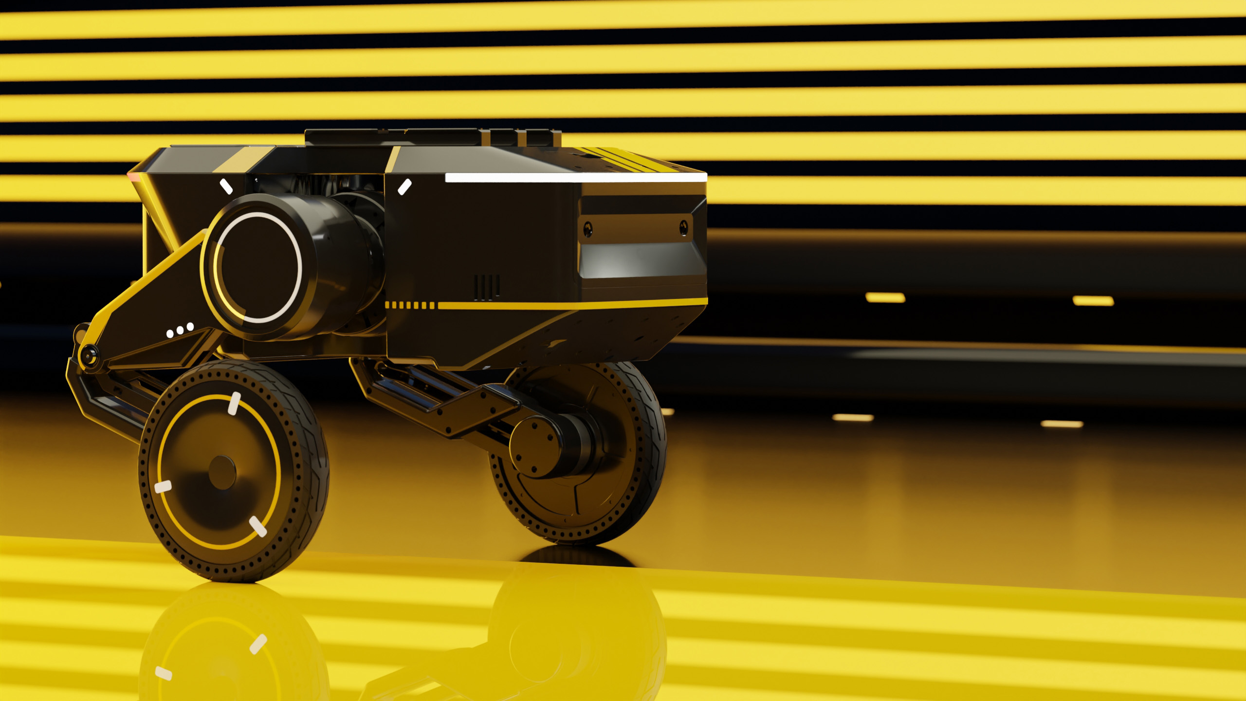
TITA Robot combines autonomous mobility, sensor integration, 3D mapping and research payload support into one robotic platform for industrial inspection and field data collection. With navigation accuracy reaching centimeter-level positioning in supported environments, multi-sensor systems including cameras, LiDAR and thermal imaging allow operators to collect structured information from complex areas. The platform supports repeatable inspection routes, digital mapping and customized research tasks, reducing manual surveys and improving data consistency.
Robotic inspection systems are increasingly used in facilities, infrastructure sites and research locations where repeated measurements are required. A mobile platform such as TITA Robot can complete scheduled inspection routes, collect visual records and provide location-based data without requiring personnel to enter every area. In industrial environments, inspection frequency can be increased from occasional manual checks to regular automated surveys.
A robotic inspection workflow can combine image capture, temperature measurement, spatial positioning and historical comparison in one data collection process.
TITA Robot integrates multiple sensing technologies to support different inspection requirements. High-resolution cameras capture surface conditions, thermal sensors identify temperature differences, and depth sensors provide three-dimensional information. In a typical mapping task, LiDAR systems can collect millions of point cloud measurements per second, while inertial sensors maintain movement estimation during navigation.
| Sensor type | Data collected | Typical application |
|---|---|---|
| RGB camera | High-resolution images and video | Surface inspection and documentation |
| Thermal camera | Temperature distribution | Equipment condition monitoring |
| LiDAR | 3D point cloud data | Spatial reconstruction and mapping |
| IMU | Motion and orientation data | Navigation support |
The combination of these sensors allows the robot to create detailed environmental models. Compared with manual measurement methods, robotic mapping provides consistent data collection across repeated missions. For example, a mapped facility area can be surveyed multiple times during different periods, allowing operators to compare structural changes using the same reference coordinates.
The mapping capability of TITA Robot is based on simultaneous localization and mapping (SLAM) technology, which enables the platform to estimate its position while building an environmental map. Modern SLAM systems can process thousands of sensor observations each second, supporting navigation in indoor environments, underground spaces and outdoor research areas.
Digital maps generated by robotic platforms can include location information, surface details and inspection records within a single spatial model.
For research applications, mobility and payload flexibility are important factors. TITA Robot supports customized equipment installation, allowing researchers to mount additional instruments according to project requirements. A single robotic platform can therefore support environmental surveys, terrain observation, infrastructure assessment and long-duration data collection.
Research missions often require repeated measurements over weeks or months. In a 2024 autonomous monitoring study, robotic platforms were used for repeated field surveys over more than 90 days, reducing the need for frequent manual site visits. Similar approaches allow researchers to collect larger datasets while maintaining consistent measurement conditions.
Direct Drive TITA provides an example of how robotic platforms can be integrated into professional inspection and research workflows through specialized hardware design and application-focused deployment.
Autonomous navigation is another important capability of modern robotic systems. TITA Robot uses perception data and navigation algorithms to plan routes, avoid obstacles and maintain stable operation. Depending on the environment, autonomous systems can reduce manual control requirements by a significant amount, especially during repeated inspection tasks.
A robot that follows predefined routes can collect comparable data from the same locations at different times, supporting long-term monitoring programs.
Communication systems allow operators to supervise missions remotely and receive collected information during operation. Real-time data transmission enables users to review images, sensor readings and robot status without remaining near the inspection area. In hazardous or restricted environments, this approach improves operational safety while maintaining access to important information.
The modular design of TITA Robot supports different mission configurations. A facility inspection project may require cameras and thermal sensors, while a scientific survey may require environmental instruments or specialized measurement devices. The same robotic base can be adapted for different tasks instead of using separate systems for each application.
| Application area | Robotic capability | Collected information |
|---|---|---|
| Industrial inspection | Automated route inspection | Images, temperature data, equipment status |
| Mapping projects | SLAM-based reconstruction | 3D models and spatial coordinates |
| Field research | Mobile sensor platform | Environmental and geographic measurements |
Data quality is improved when inspection methods remain consistent. Human inspections may vary between operators, while robotic platforms can repeat the same route, sensor configuration and measurement procedure. For organizations managing large facilities, this creates a structured record of equipment conditions across different periods.
Artificial intelligence is also expanding the capability of robotic inspection systems. Machine learning models can analyze images, classify surface conditions and identify unusual patterns from collected datasets. In recent applications, computer vision systems trained with thousands of labeled images have achieved improved accuracy in identifying visual conditions compared with manual review processes.
The development of autonomous robots continues to expand applications in inspection, mapping and research. Advances in sensor technology, computing performance and navigation algorithms allow platforms such as TITA Robot to operate in more complex environments. In 2025, the global industrial robotics market continued increasing adoption of mobile robotic systems, with inspection and logistics among the major application areas.
TITA Robot provides a flexible platform that connects robotic movement, sensor collection and digital information management. Through autonomous navigation, high-resolution sensing and modular payload support, the system can assist professional users in collecting reliable information across industrial, environmental and research environments.